


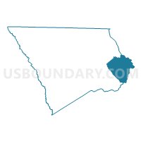
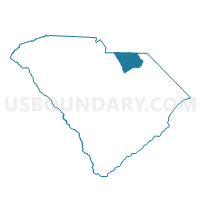
Cash Voting District, Chesterfield County, South Carolina
About
Outline

Summary
| Unique Area Identifier | 665457 |
| Name | Cash Voting District |
| County | Chesterfield County |
| State | South Carolina |
| Area (square miles) | 53.95 |
| Land Area (square miles) | 52.61 |
| Water Area (square miles) | 1.34 |
| % of Land Area | 97.52 |
| % of Water Area | 2.48 |
| Latitude of the Internal Point | 34.61431500 |
| Longtitude of the Internal Point | -79.84006530 |
Maps

Graphs
Select a template below for downloading or customizing gragh for Cash Voting District, Chesterfield County, South Carolina


Neighbors
Neighoring Voting District (by Name) Neighboring Voting District on the Map
- Cheraw No. 3 Voting District, Chesterfield County, SC
- Grants Mill Voting District, Chesterfield County, SC
- Patrick Voting District, Chesterfield County, SC
- Pee Dee Voting District, Chesterfield County, SC
- Quicks X Roads Voting District, Marlboro County, SC
- Society Hill Voting District, Darlington County, SC
- West Bennettsville Voting District, Marlboro County, SC
Top 10 Neighboring County Subdivision (by Population) Neighboring County Subdivision on the Map
- Bennettsville CCD, Marlboro County, SC (16,365)
- Cheraw CCD, Chesterfield County, SC (14,516)
- Patrick CCD, Chesterfield County, SC (5,393)
- Society Hill CCD, Darlington County, SC (3,616)
- Wallace CCD, Marlboro County, SC (3,287)
Top 10 Neighboring Unified School District (by Population) Neighboring Unified School District on the Map
- Darlington County School District, SC (68,681)
- Chesterfield County School District, SC (46,734)
- Marlboro County School District, SC (28,933)
Top 10 Neighboring State Legislative District Lower Chamber (by Population) Neighboring State Legislative District Lower Chamber on the Map
- State House District 53, SC (34,472)
- State House District 54, SC (32,159)
- State House District 56, SC (32,076)
Top 10 Neighboring State Legislative District Upper Chamber (by Population) Neighboring State Legislative District Upper Chamber on the Map
Top 10 Neighboring 111th Congressional District (by Population) Neighboring 111th Congressional District on the Map
Top 10 Neighboring Census Tract (by Population) Neighboring Census Tract on the Map
- Census Tract 9602, Marlboro County, SC (6,264)
- Census Tract 9506, Chesterfield County, SC (6,113)
- Census Tract 9507, Chesterfield County, SC (5,393)
- Census Tract 101, Darlington County, SC (3,616)
- Census Tract 9601, Marlboro County, SC (3,287)